
Last update: July 25, 2020
Due to the coronavirus epidemic, we will make all the arrangements needed to keep everybody safe.
A: Yes, you can register now and add a partner later.
Q: Are start and finish in competition centre?
A: The finish is in the competition centre. The location of the start will be published in team meeting at July 31st. Start is max. 3 km from the event center.
Q: Is the course linear or more like a cloud of CPs, like in rogaining?
A: It is linear*. But you can (and most likely must) skip last CPs to finish in time (120 hours). In other words, you take CPs in numerical order and take a shortcut to finish when there is still enough time to get there before deadline.
Q: If the course is linear, most teams will follow each other, right? At least the first day.
A: We think that route choices and speed will separate teams quite well already from the start.
Q: How many CPs will there be? How difficult are they to find?
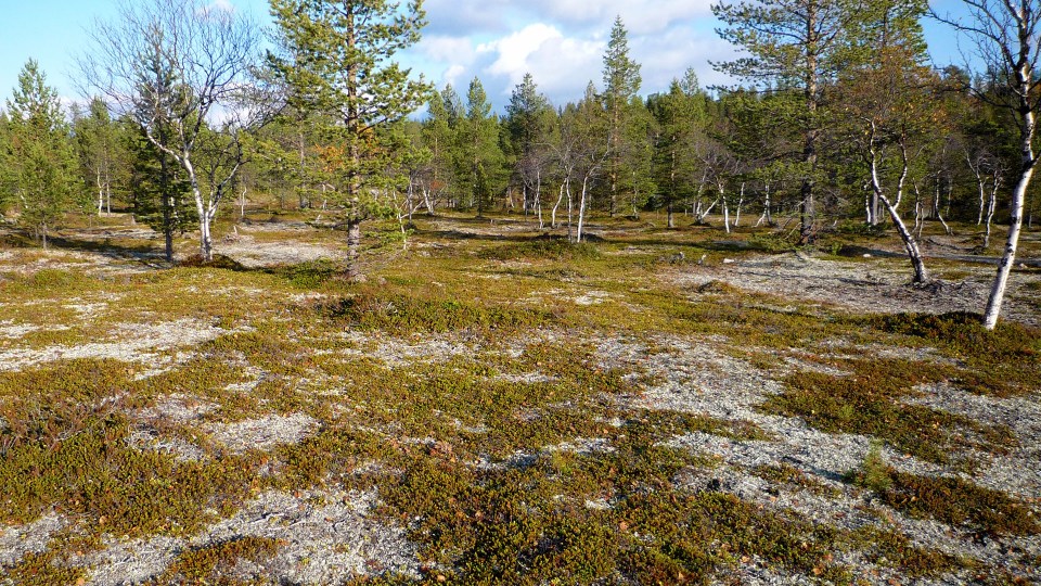
A: Good navigation skills will be needed. The course will consist of 20–30 CPs. Most of them are “quite easy” (small lake), some “very easy” (top of the fell) and some “quite demanding” (very small pond in a very detailed area) – for an experienced orienteer.
Q: How long the course is?
A: The course is approximately 400 kilometers long (as crow flies). Shortest reasonable route is 500 kilometers.
Q: What if our team is too tired to continue racing after three days?
A: Find a nice place to camp, rest, and enjoy the spectacular scenery. There is pure drinking water everywhere and endless amount of great places to stay.
Q: What if we are so slow that we have no chance at all to complete the entire course?
A: Our prediction is that most of the teams will not be able to do that. That’s why the course is designed so that it is really interesting even if you can take only a small fraction of it.
Q: Will be there any runnable roads or tracks on the course or just wild bush?
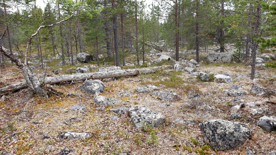
A: There are a few small tracks but no roads to follow. The walkability of the terrain varies a lot, from very slow rocky areas to superfast plains. Prepare also to cross small rivers.


See also: YouTube-videos from Vätsäri and Kaldoaivi.
Q: Will there be any resupply points, or does all food need to be carried from the start?
A: There is a grocery store about halfway down the route, but you have to do an extra 10 kilometer loop to get there. And “halfway” means 2–3 days for fastest teams and 5+ days for slowest.
Q: Are we allowed to make a stash? To leave something behind to be picked up later in the race. For example leaving everything else but mandatory gear behind when visiting a CP on top of a hill, or leaving part of the food supplies to be picked up two days later?
A: Yes you are. But
1) you have to have mandatory gear always with you and
2) you are not allowed to leave anything in the terrain.
Q: What kind of fire are we allowed to make?
A: If the official forest fire warning is in force, it is forbidden make any kind of open fire (campfire, pocket stove/hobo stove).
Forest fire warning is quite common in Finland in July/August, so prepare to make you meals without open fire. You can still use stove.
See more information on forest fire warnings in Finland and the current situation.
IF the forest fire warning is not in force, you can collect loose braches and twigs to make a fire, but you are not allowed to hew down a tree.
Q: What kind of map will we use?
A: The main map is standard topographical map made by National Land Survey of Finland. You can browse the map here. See also map legend. The scale of the main map is 1:50 000 and the paper size is A3.
Q: How many maps we will have?
A: GPS is not allowed, you have to orienteer only with the map and a compass.
A: You’ll get an gps device from organizers. Gps service like this is provided by Sportrec. You can also use a basic GPS reciever (data logger) with no screen.
Q: Are activity trackers allowed? As in devices, that do not contain a GPS, but have a step counter for tracking, like Garmin Vivofit/-move/-smart?
A: Yes, there will be GPS tracking provided by Sportrec.
Q: What is the purpose of action camera as mandatory equipment?
A: Action camera is used
1) as a reserve “punching device” in case the control flag and punch is missing,
2) as a tool to document the trip: every team has to shoot few short clips* of their race. After the race, the footage** will be handed to organizers, who will use it as a part of the official race video.
* at least 30 seconds and 2 clips (e.g. two 15 sec clips or six 5 sec clips)
** only the clips that team wants to share
Q: Are packrafts allowed?
A: Yes, they are. But is a packraft really useful? Probably not. There are not that many rivers to use as a route. A lot of lakes though.
Q: Do you consider IPx4 headlamps waterproof?
A: The list of mandatory equipment will be published next spring is published, but some small changes might occur.
Q: Are there a lot of mosquitoes at that time in Lapland?
A: The amount of mosquitoes varies a lot from year to year. July is the worst month and in August the amount decreases. Last year (2019) there were no mosquitoes at all in the first week of August – but the temperature was much lower than normally (+3–+8°C).
The amount of insects varies also depending on where you are. The open fell areas are often free from mosquitoes while the lowlands near water are less free…
It really pays off to protect yourself against mosquitoes. A mosquito headnet and repellent are highly recommended.
Q: Are there any bears? Any bear safety requirements?
A: There may be some bears but you won’t see them. Brown bears are afraid of people and won’t disturb us.
If you want to be 100 % sure you should store all your food in an air-tight bag outside the tent. But people hiking in Lapland usually don’t do that.
Q: What if our team wins?
A: You’ll get a small price and lots of glory. 🙂
Any other questions? Ask us!

